
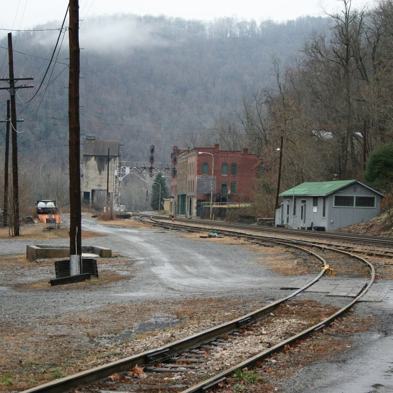
Some American towns did not drift away over generations. People simply walked out, pulling the door shut on houses, stores, machinery and cars left standing right where they stood. The desert and the forest moved in. The rest stayed put.
We went through Wayfarrow’s map of 10,908 U.S. ghost-town records, built from USGS place names, Wikidata and the National Park Service. From those, we kept the towns with buildings, machinery or vehicles still on site and a well-documented past, then picked the ones where the most was left behind and where good, freely licensed photographs exist.
The list counts down to the most complete ghost town in the country. We begin at the bottom of the list.
27. Standardville, Utah
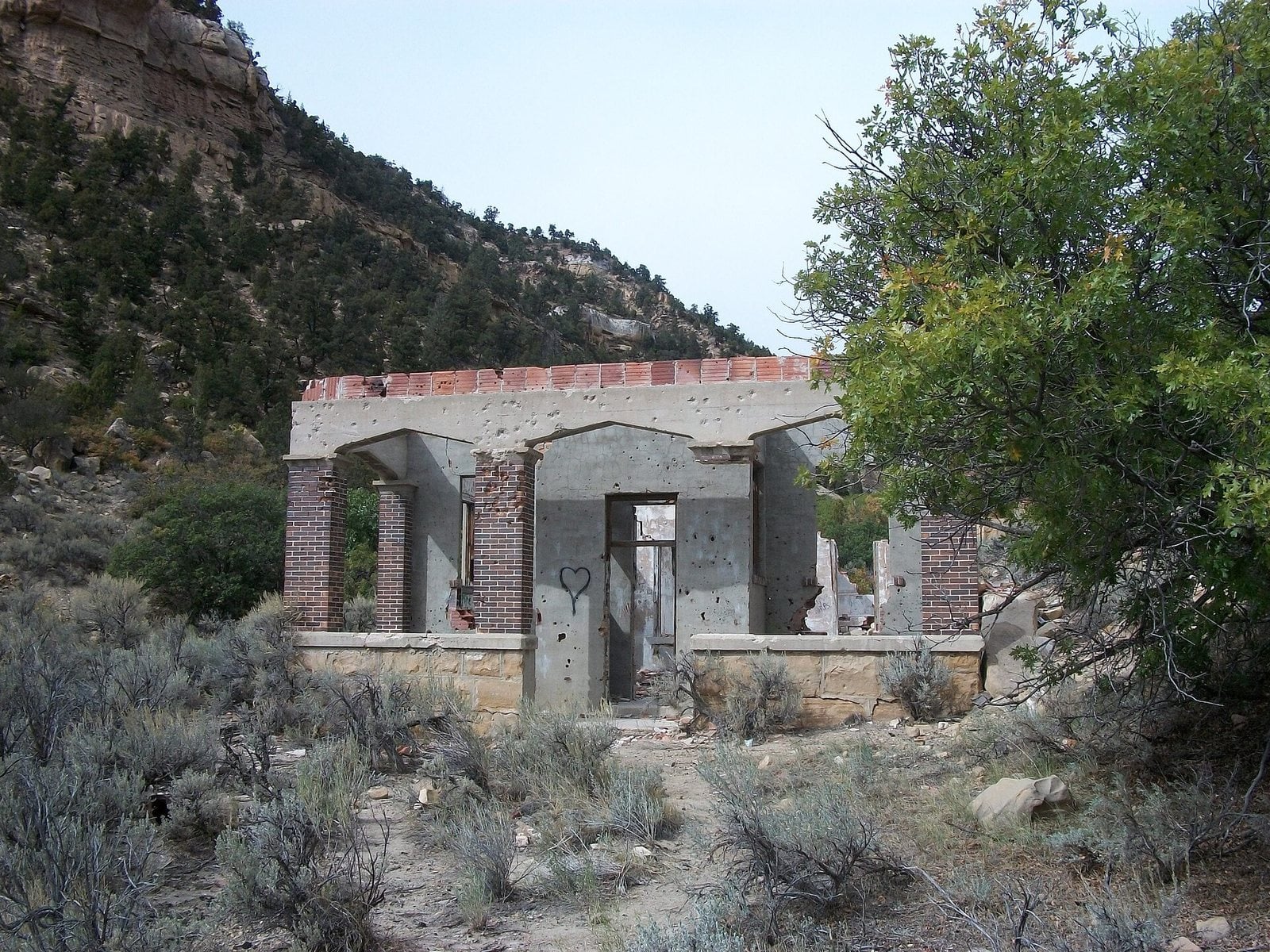
Ruins in Standardville, Utah. Photo: The Utahraptor (talk) / Wikimedia Commons, CC BY-SA 3.0
Standardville began in 1912, after coal turned up in Spring Canyon. The layout was so carefully planned, with lawns, bushes and poplar trees, that it became the model other mining towns were meant to copy. Hence the name. A company store, apartments, a butcher shop, a barber shop, a hospital, a recreation hall, tennis courts and an elementary school all followed.
It was never entirely peaceful. In 1922, striking miners killed a mine guard and wounded two others before escaping. In 1930, 20 miners died in a mine explosion caused by carbon monoxide gas. When the mine shut down in 1950, people began to pack up and move on. The shops, the hospital and the school all closed in turn.
What survives sits at 6,746 feet, four miles from Helper. The coal tipple has deteriorated, though the coal storage unit remains, along with numerous foundations. The town is now fenced off and posted as private property, but most of the ruins can be seen from the road.
- Founded: 1912
- Elevation: 6,746 ft
- Nearest living town: Helper, UT, 4 miles in a straight line
Explore Standardville on Wayfarrow: map, old USGS topo and today’s aerial view (Source)
26. Gleeson, Arizona
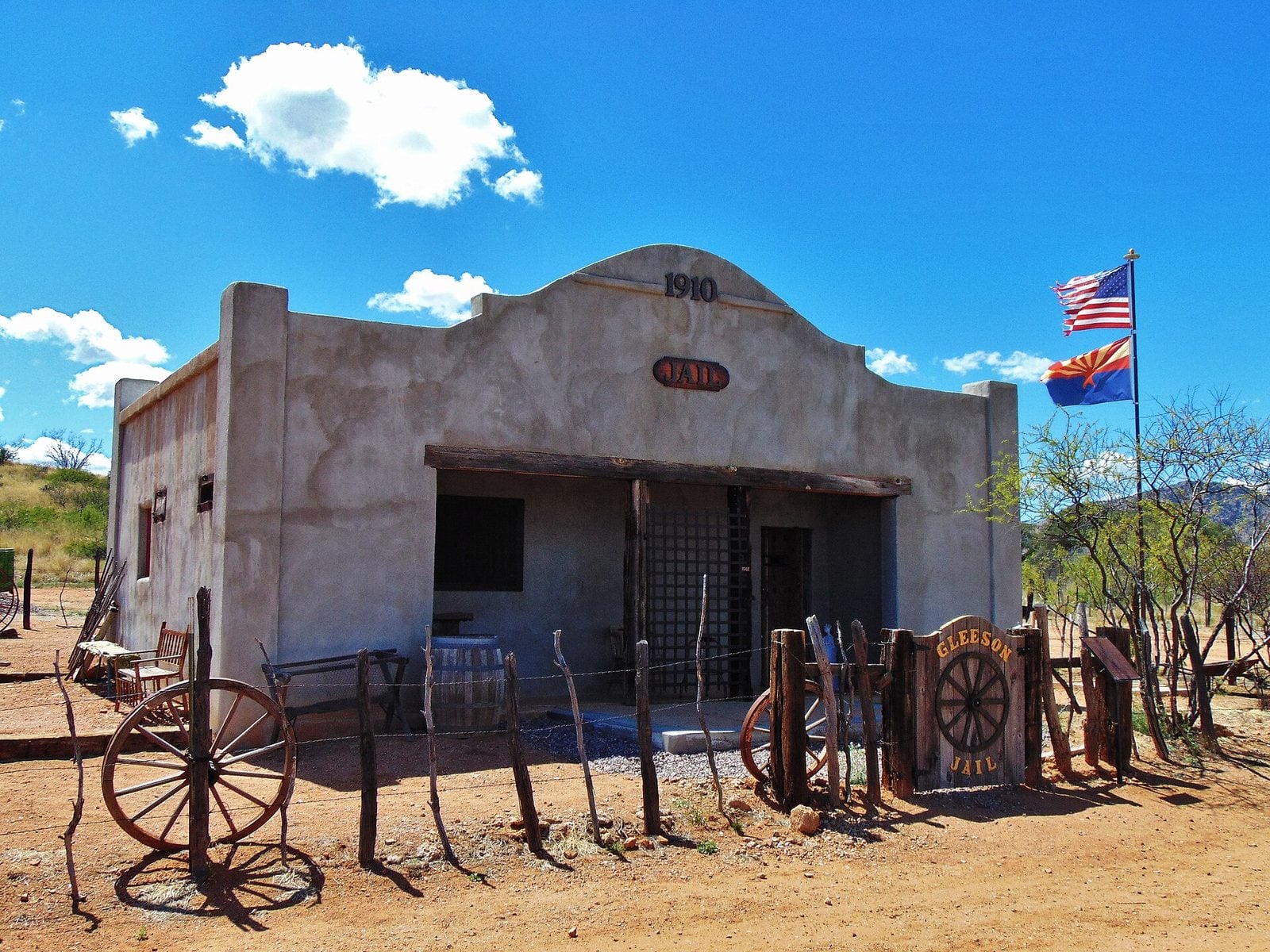
The 1910 jail in Gleeson, Arizona. Photo: The Old Pueblo / Wikimedia Commons, CC BY-SA 4.0
Gleeson started life in the 1870s as Turquoise, named for the mineral that Native Americans had mined here first. The post office opened in October 1890 and lasted only a few years. When local miner John Gleeson registered a copper claim and opened the Copper Belle Mine, a new town rose just downhill from the old one. Silver Bill, Pejon and Defiance mines followed in the hills around it.
The last commercial venture, a rattlesnake products store, closed in 2014. Several families still live on the site, but by every other measure this is a ghost town.
At 4,923 feet, roughly nine miles from tiny Elfrida, visitors can find the ruins of a hospital, a saloon, a cemetery, a jail, the foundation of the village school, and plenty of evidence of the mining that once filled the surrounding hills.
- Elevation: 4,923 ft
- Nearest living town: Elfrida, AZ, 9.2 miles in a straight line
Explore Gleeson on Wayfarrow: map, old USGS topo and today’s aerial view (Source)
25. Fairbank, Arizona
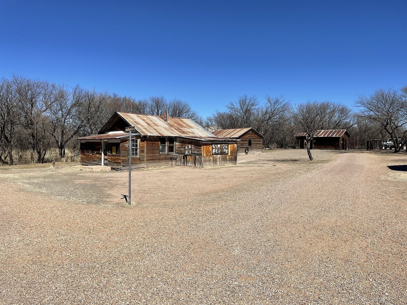
The surviving buildings of Fairbank, Arizona. Photo: BLMArizona / Wikimedia Commons (public domain)
Fairbank sat on the San Pedro River and, from 1881, served as the closest rail stop to Tombstone, which made it a hub in the growth of southeastern Arizona. It was named for a Chicago investor who helped finance the railroad and founded the Grand Central Mining Company, with its stake in Tombstone silver.
The spot had deep roots, once the site of a Native American village in the 18th century. It went through several names, Junction City, then Kendall, then Fairbanks, before being formally founded as Fairbank in May 1883, the same day the post office opened. A stage coach station arrived in 1885.
At its height in the mid-1880s, about 100 residents lived here with a steam quartz mill, a general store, a butcher shop, a restaurant, a saloon, a Wells Fargo office, the depot and the stage station. By the mid-1970s it was all but deserted, and the final residents left when the buildings were deemed unsafe. Today it lies within the San Pedro Riparian National Conservation Area, at 3,860 feet.
- Elevation: 3,860 ft
- Nearest living town: Whetstone, AZ, 6.1 miles in a straight line
Explore Fairbank on Wayfarrow: map, old USGS topo and today’s aerial view (Source)
24. Lobo, Texas
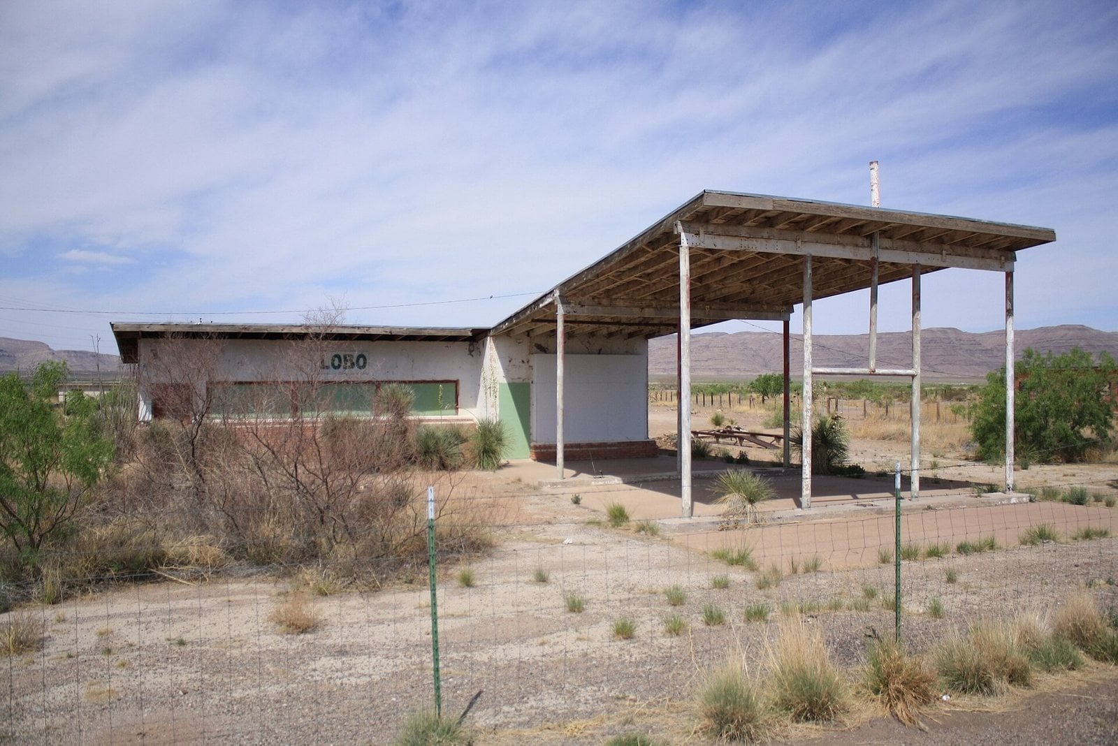
Abandoned buildings at Lobo, Texas. Photo: panda brand / Wikimedia Commons, CC BY-SA 2.0
Lobo’s story reaches back to the mid-19th century, when a bolson aquifer called Van Horn Wells was found in the area. The springs became a stop on the San Antonio-El Paso Road, then a waypoint for emigrants heading west.
The San Antonio-San Diego Mail Line and the Butterfield Overland Mail passed through, along with other mail routes from 1857 until the railroads arrived and the traffic shifted elsewhere.
Later, one owner bought the entire community and opened a new gas station and general store to keep it alive. With no buyer and personal troubles mounting, he gave up, and Lobo was abandoned in 1991, its buildings left standing beside the highway. Years later, three residents of Frankfurt, Germany, bought the empty town. It sits at 4,039 feet, about 16 miles from Van Horn.
- Elevation: 4,039 ft
- Nearest living town: Van Horn, TX, 16.4 miles in a straight line
Explore Lobo on Wayfarrow: map, old USGS topo and today’s aerial view (Source)
23. Swansea, Arizona
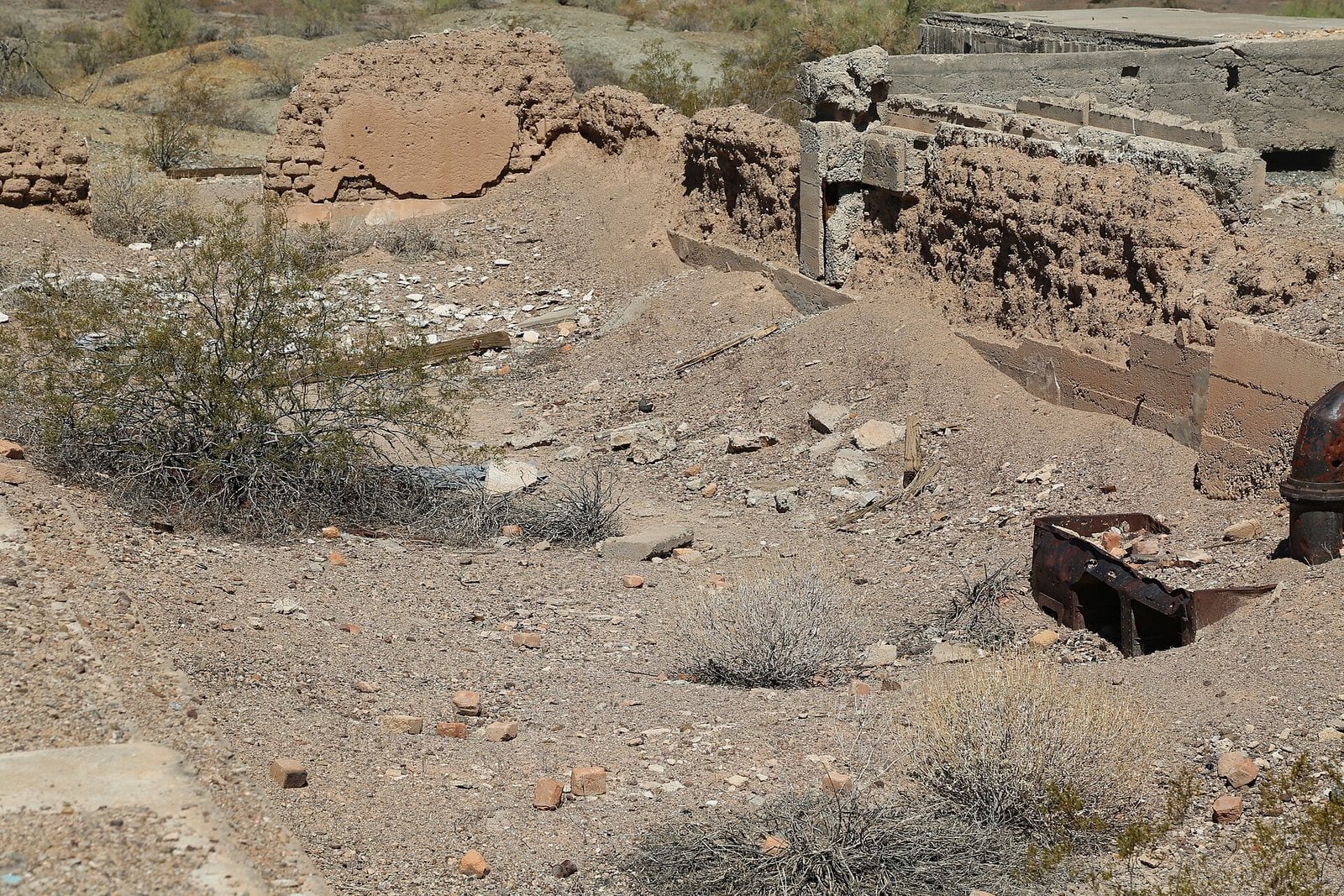
Remains of the mess hall at Swansea, Arizona. Photo: BLMArizona / Wikimedia Commons (public domain)
Prospecting around Swansea began circa 1862, but the remote location and lack of transport kept things slow. That changed around 1904, when the railroad reached nearby Parker and two miners, Newton Evans and Thomas Jefferson Carrigan, saw their chance. The town itself took shape circa 1909 as a place to process and smelt copper ore from the nearby mines.
Within a few years the pair had built a 350-ton furnace, a water pipeline to the Bill Williams River, and hoists for five mine shafts. They first called the place Signal. The good times did not last. By 1911, the Clara Consolidated Gold and Copper Mining Company was in financial trouble.
At 1,292 feet, nearly 18 miles from Parker Strip, you can still see a number of adobe structures, the remains of the railroad depot, two cemeteries and several mine shafts.
- Elevation: 1,292 ft
- Nearest living town: Parker Strip, AZ, 17.6 miles in a straight line
Explore Swansea on Wayfarrow: map, old USGS topo and today’s aerial view (Source)
22. Silver Reef, Utah
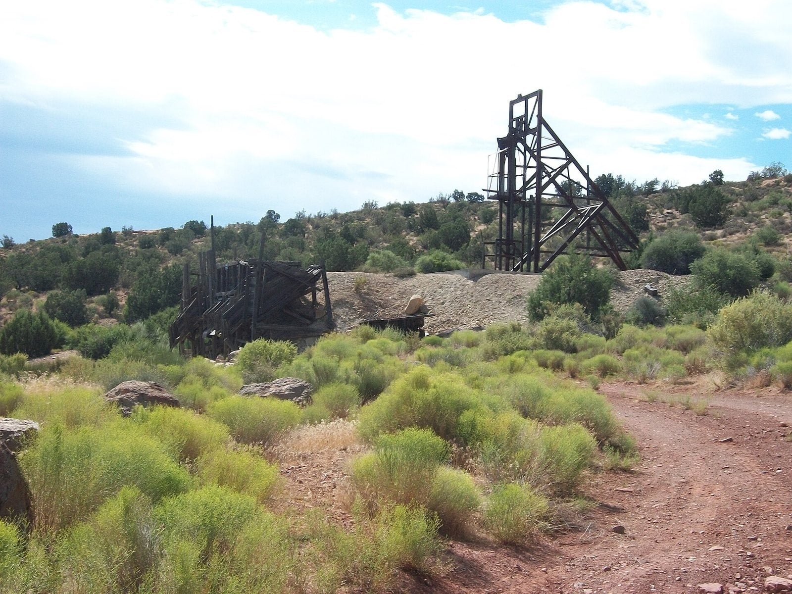
A mine headframe at Silver Reef, Utah. Photo: The Utahraptor / Wikimedia Commons, CC BY-SA 3.0
A prospector found a vein of silver in sandstone here in 1866, which puzzled geologists, since silver is not usually found that way. He left for Nevada when the ore proved thin. In 1875, two Salt Lake City bankers sent William Barbee to stake claims. He staked 21, miners poured in, and Barbee founded a town he called Bonanza City.
By 1878 the business district held a hotel, boarding houses, nine stores, six saloons, five restaurants, a bank, two dance halls, a newspaper and eight dry goods stores. Fire struck in May 1879, discovered under a restaurant. Hundreds of residents hauled buckets of water from Leeds Creek and draped wet blankets over nearby buildings, but the flames reached the Harrison House Hotel, one of the town’s finest.
Many merchants went bankrupt and left town. Long before any of this, the land belonged to Ancestral Puebloans, farmers and potters whose work can still be found in abandoned villages. Some of the area has been preserved for its history: the Wells Fargo office, the Cosmopolitan Restaurant and the Rice Building still stand among numerous foundations and walls, though a few dozen homes have since been built nearby. Silver Reef sits at 3,791 feet, close to Leeds.
- Founded: 1875
- Elevation: 3,791 ft
- Nearest living town: Leeds, UT, 1.6 miles in a straight line
Explore Silver Reef on Wayfarrow: map, old USGS topo and today’s aerial view (Source)
21. Hardman, Oregon
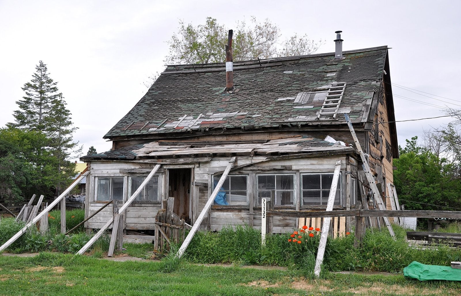
A collapsing house in Hardman, Oregon. Photo: Finetooth / Wikimedia Commons, CC BY-SA 4.0
Hardman sits on a plateau in southern Morrow County, on Oregon Route 207, with Rock Creek flowing past on its way to the Columbia. In the late 1800s, the newspapers could not say enough about it, praising the “thriving little trade center” and the farmland around it as “one of the best farming sections” anywhere, and the country as “the greatest stock range in the West.”
It was a social and commercial hub for the surrounding farms. Then a railroad reached Heppner in the 1920s, trade shifted, and Hardman became a ghost town.
The main commercial building still standing, the Hardman IOOF Lodge Hall, was added to the National Register of Historic Places in 2012. The nearest living town is Lonerock, 11 miles off, with a population of 23. Hardman sits at 3,563 feet.
- Elevation: 3,563 ft
- Nearest living town: Lonerock, OR, 11.3 miles in a straight line
Explore Hardman on Wayfarrow: map, old USGS topo and today’s aerial view (Source)
20. Ludlow, California
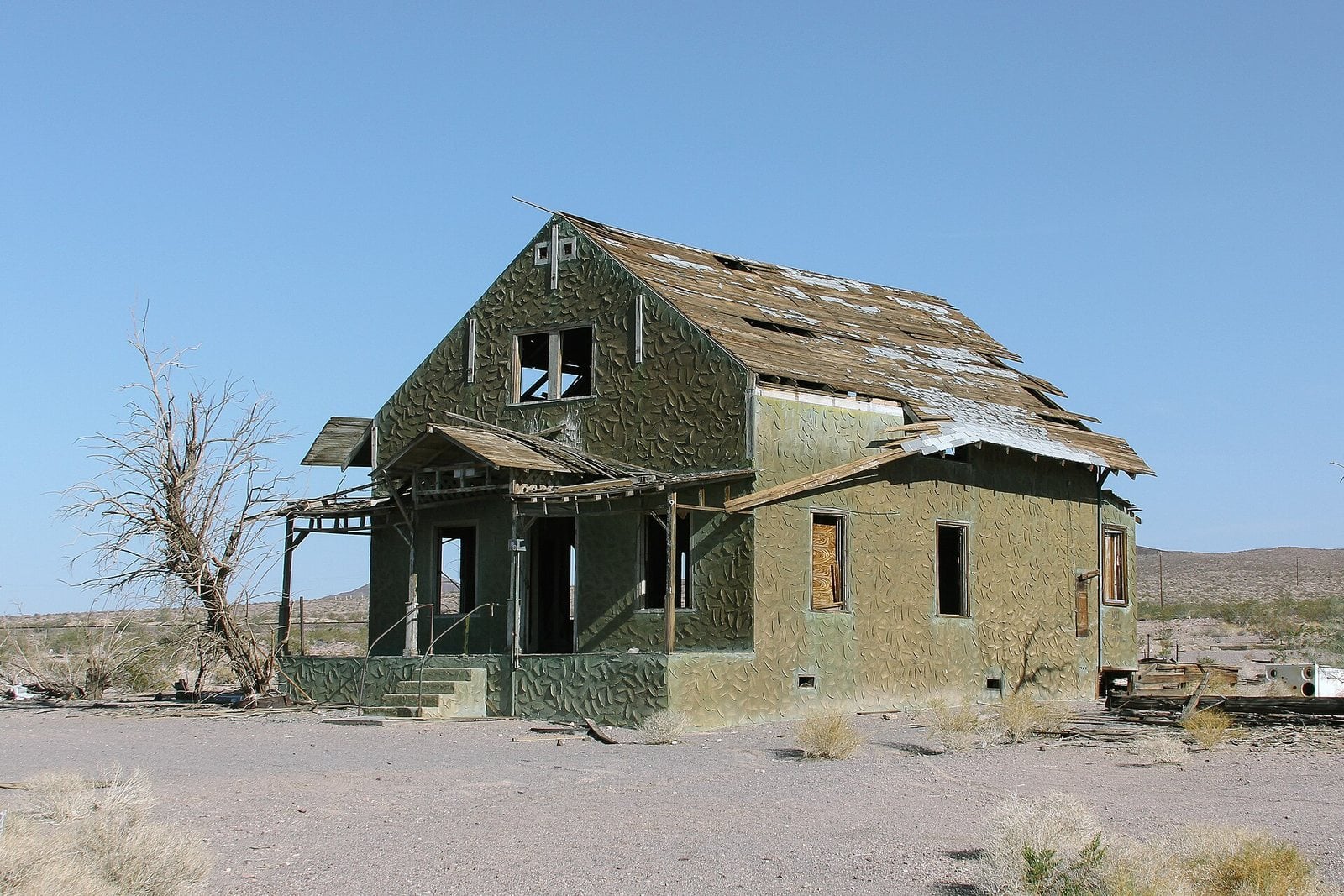
An abandoned house in Ludlow, California. Photo: el-toro / Wikimedia Commons, CC BY 2.0
Ludlow was founded in 1882 and grew up along what became historic Route 66, out in the Mojave Desert. The older remains of the ghost town still line that old highway.
One family’s story anchors the place. Lee Yim, his wife Guishee Yim, and their five children lived here from 1914 into the 1960s, running The Desert Inn Cafe and Hotel.
When Interstate 40 was built and bypassed the town, business dried up and most residents left. What they left behind are empty buildings and the Tamarisk trees that still stand, flanking the old highway. Ludlow sits at 1,777 feet. The nearest living town is Homestead Valley.
- Founded: 1882
- Elevation: 1,777 ft
- Nearest living town: Homestead Valley, CA, 34.2 miles in a straight line
Explore Ludlow on Wayfarrow: map, old USGS topo and today’s aerial view (Source)
19. Home of Truth, Utah
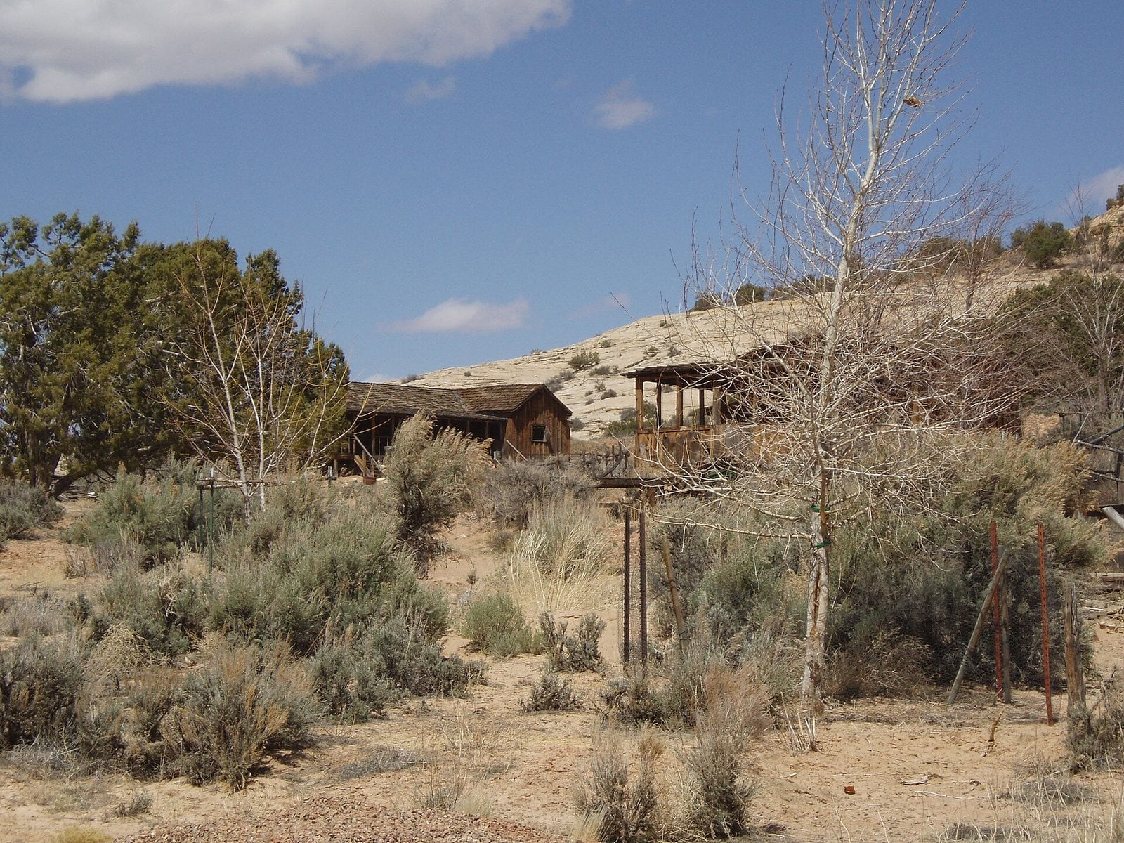
The Inner Portal at Home of Truth, Utah. Photo: Ntsimp / Wikimedia Commons (public domain)
Home of Truth was a short-lived utopian religious community, founded in 1933 under spiritualist leader Marie Ogden. It began with 22 people and grew to around 100 at its peak. Life was strict and simple, the residents keeping to themselves, socially and physically apart from the world around them. They made their own furniture and household goods by hand, and Ogden ran the local newspaper to spread her beliefs.
The trouble came from Ogden’s writings about an effort to raise a woman from the dead. The press ran sensational accounts, more than half the colonists left disillusioned, and in February 1937 Ogden announced that Edith Peshak was about to return to life. Investigators insisted on a death certificate; Ogden kept claiming the woman was not actually dead.
Ogden still had the corpse, washed three times a day in a salt solution. The authorities found Peshak’s body well preserved. After her arrest, Ogden signed the certificate in May 1937. Today the site sits at 6,225 feet, about 14 miles from Monticello, where Ogden once made her shopping trips.
- Founded: 1933
- Elevation: 6,225 ft
- Nearest living town: Monticello, UT, 13.6 miles in a straight line
Explore Home of Truth on Wayfarrow: map, old USGS topo and today’s aerial view (Source)
18. Burke, Idaho
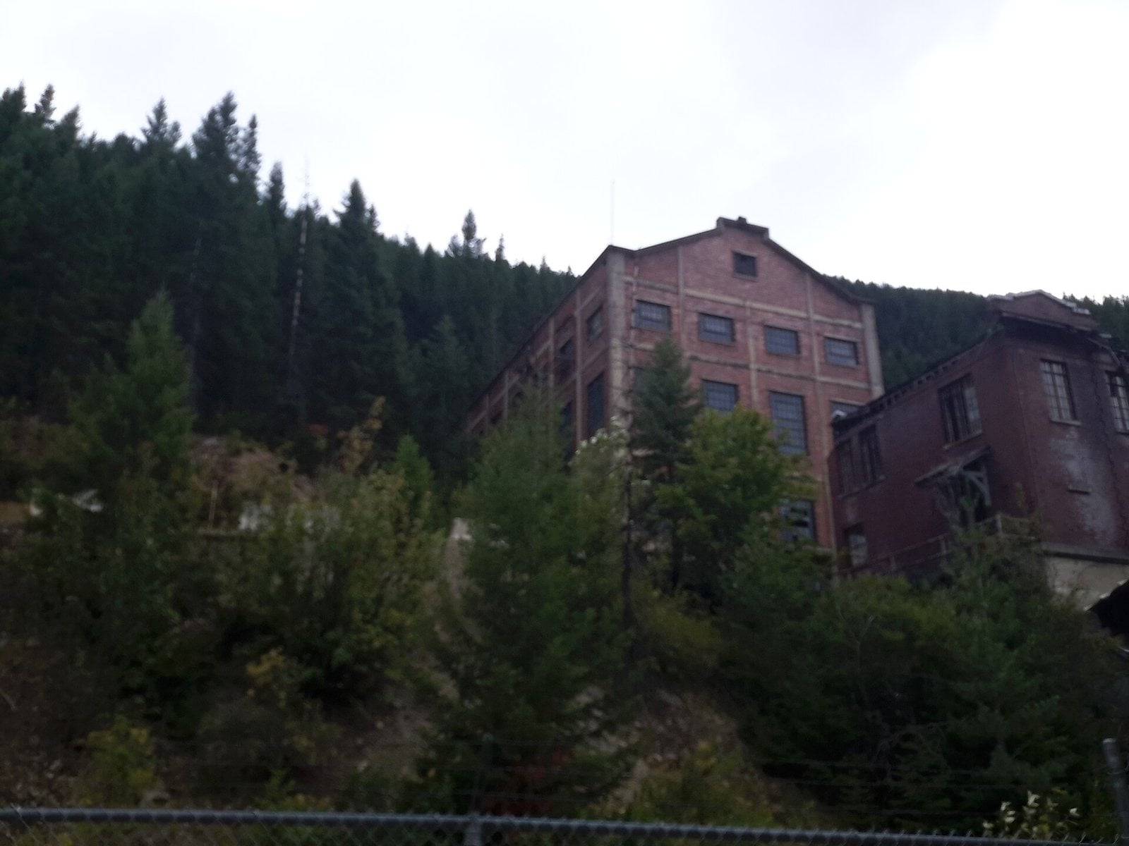
An old brick mine building in Burke Canyon, Idaho. Photo: Kyle kersey / Wikimedia Commons, CC BY 2.0
Burke was established in 1887 and became a thriving silver, lead and zinc community. It was home to the Hercules mine, whose owners were caught up in the Idaho mining wars of 1899, and the Hecla and Star mines also worked out of here. The town played a part in the 1892 Coeur d’Alene labor strike.
Its setting was extraordinary. Burke sat inside a canyon only 300 feet wide, which forced some remarkable building. A hotel went up above the railway and Canyon Creek, with the train track running straight through a portion of the hotel lobby.
By the mid-twentieth century, mine after mine closed. By 1990, census data counted just fifteen residents. Mining finally ceased in 1991 with the closing of the Star mine. The town sits at 3,718 feet, less than four miles from Mullan.
- Founded: 1887
- Elevation: 3,718 ft
- Nearest living town: Mullan, ID, 3.7 miles in a straight line
Explore Burke on Wayfarrow: map, old USGS topo and today’s aerial view (Source)
17. Sego, Utah
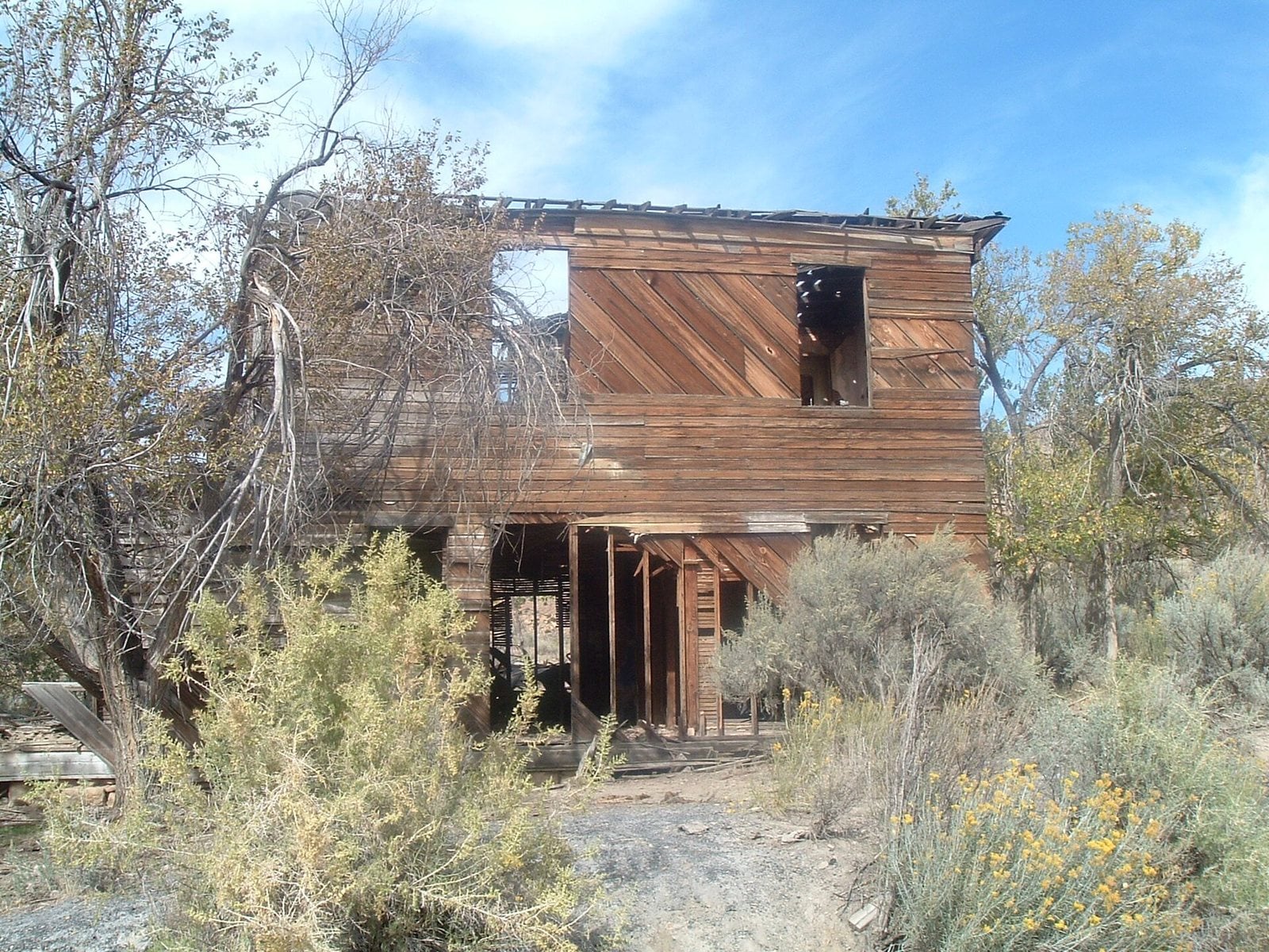
A collapsing two-story building in Sego, Utah. Photo: Davemeistermoab / Wikimedia Commons, CC BY-SA 3.0
Henry Ballard, a founder of nearby Thompson Springs, found an exposed vein of anthracite coal here in 1908 while exploring the Book Cliffs. He bought the land and hired local laborers, and the coal camp naturally took his name. The town of Sego, in its narrow, winding canyon, was inhabited from about 1910 to 1955. By 1911 Ballard had sold out to a Salt Lake City businessman.
The coal was hauled out on the Ballard & Thompson Railroad, a 5.25-mile spur the founders built. It never owned its own equipment and leaned on the Rio Grande for locomotives. The end came when costs outran income. By 1947 the mine was closing down, and the miners, who had once numbered 125, were reduced to just 27, many returning with back pay still owed.
Much of the historic area was listed on the National Register of Historic Places in October 2017. The ramp and much of the railroad grade survive, along with three of the many single-span trestles crossing the wash. Sego lies at 5,709 feet, about 25 miles from Green River.
- Founded: 1910
- Elevation: 5,709 ft
- Nearest living town: Green River, UT, 25.4 miles in a straight line
Explore Sego on Wayfarrow: map, old USGS topo and today’s aerial view (Source)
16. Rodney, Mississippi
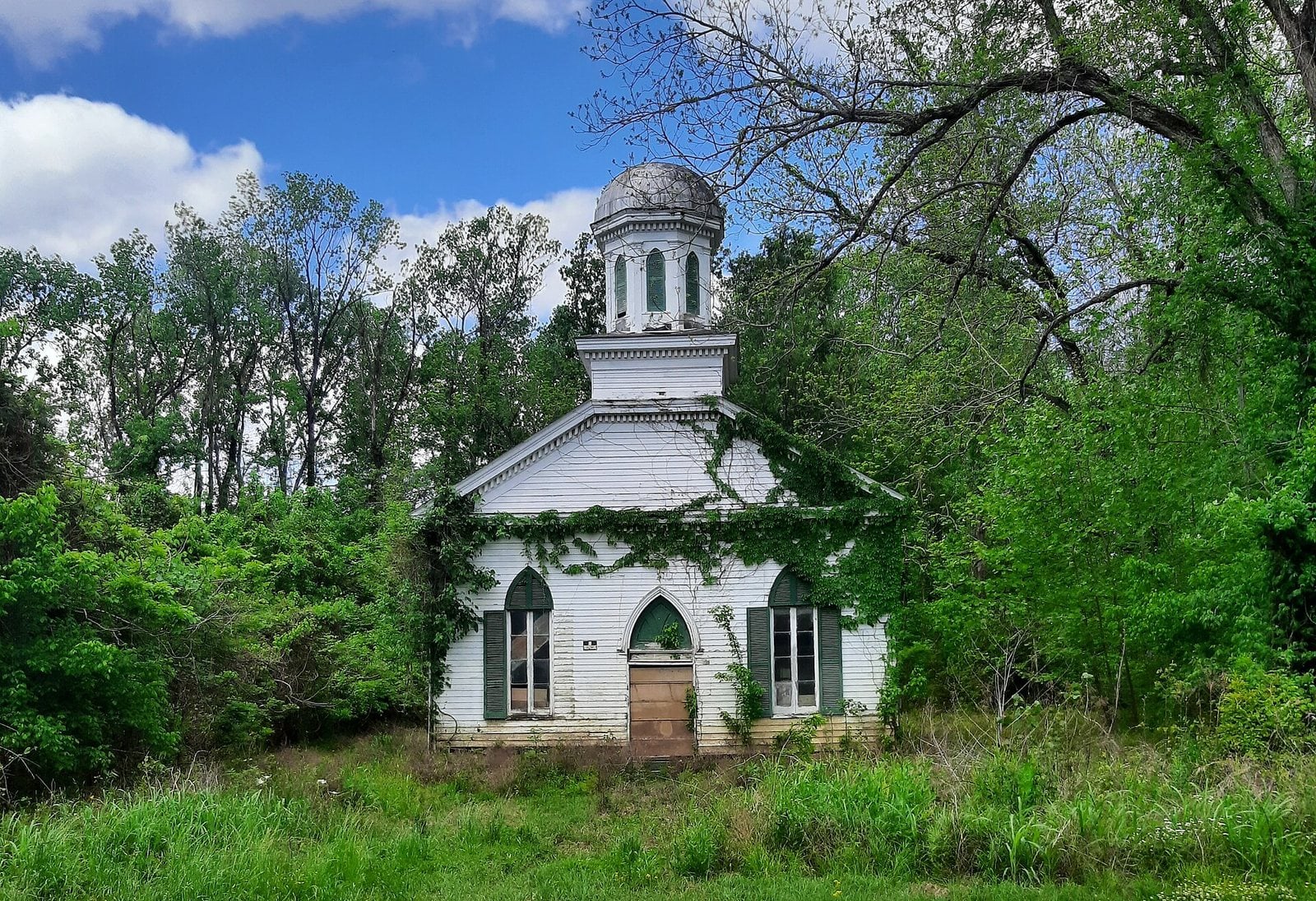
The abandoned Baptist church in Rodney, Mississippi. Photo: Robert Jones / Wikimedia Commons, CC BY-SA 4.0
Founded in 1828, Rodney once held thousands of people. By 1860 it had banks, newspapers, schools, a lecture hall, Mississippi’s first opera house, a hotel and more than 35 stores. The landing had long been a key waypoint on Native American routes around the Mississippi Delta, and the Natchez people likely used it as a portage between the river and White Apple Village.
The Civil War hollowed the town out. Many men who left during the war never came back, and many businesses closed for good. The Mississippi River, which once made Rodney, shifted away, and the town now sits about two miles inland.
Today the river returns in a different form: the town floods regularly, and buildings carry extensive flood damage. Most of the buildings are gone, and the rest stand in various states of disrepair. Only a small number of people still live in the area. The Rodney History and Preservation Society is restoring the Presbyterian Church, whose Civil War façade holds a replica cannonball above its balcony windows. Mount Zion Baptist is now completely abandoned. Rodney sits at just 82 feet.
- Founded: 1828
- Elevation: 82 ft
- Nearest living town: Alcorn State University, MS, 3.7 miles in a straight line
Explore Rodney on Wayfarrow: map, old USGS topo and today’s aerial view (Source)
15. Terlingua, Texas
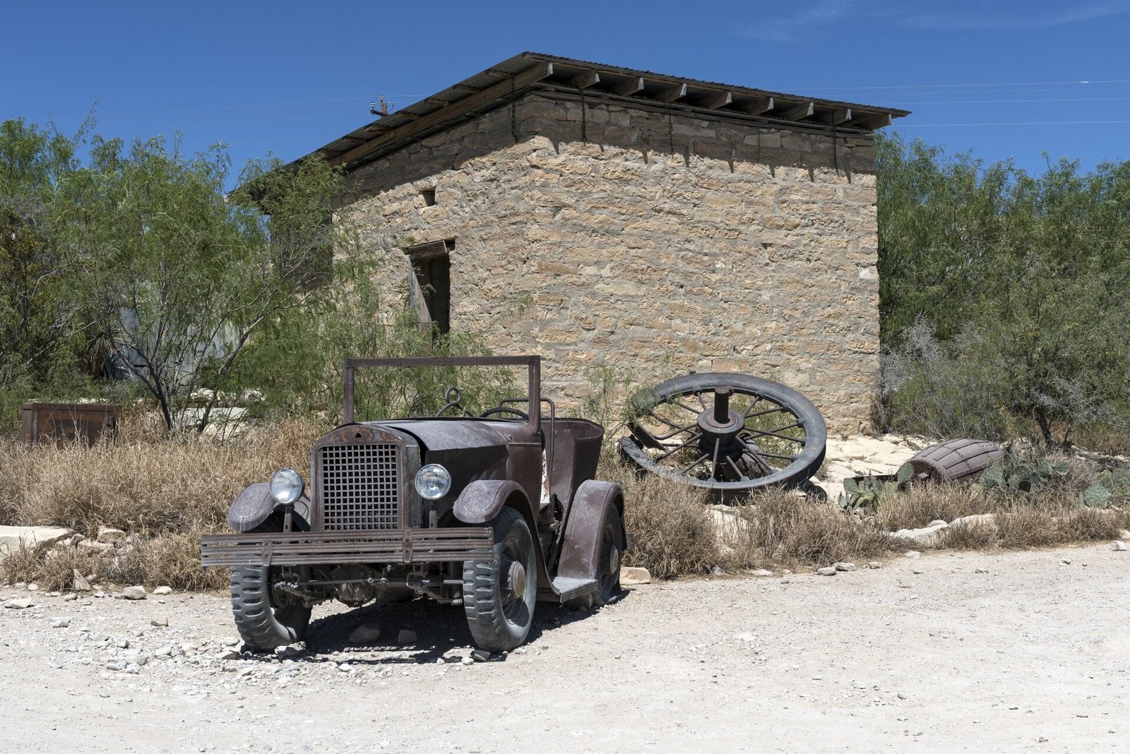
An old jalopy outside an abandoned stone building in Terlingua, Texas. Photo: Carol M. Highsmith / Wikimedia Commons (public domain)
The discovery of cinnabar, the ore that yields mercury, in the mid-1880s drew miners to this stretch of southwestern Brewster County, near the Rio Grande. At its height the district held a city of 2,000 people. A man named Jack Dawson reportedly produced the first mercury here in 1888, though the district was slow to find its footing until the mid-1890s.
By 1900, four mining companies had recovered 1000 flasks in the district, and by 1903 three more had joined them. The mineral terlinguaite was first found near California Hill, the sort of detail that still draws the curious.
What remains is the ghost town of the Howard Perry-owned Chisos Mining Company and several capped, abandoned mines nearby, the California Hill, the Rainbow, the 248 and the Study Butte. The population as of 2020 was 78. Terlingua sits at 2,892 feet, a few miles from Study Butte.
- Elevation: 2,892 ft
- Nearest living town: Study Butte, TX, 4.5 miles in a straight line
Explore Terlingua on Wayfarrow: map, old USGS topo and today’s aerial view (Source)
14. Grafton, Utah
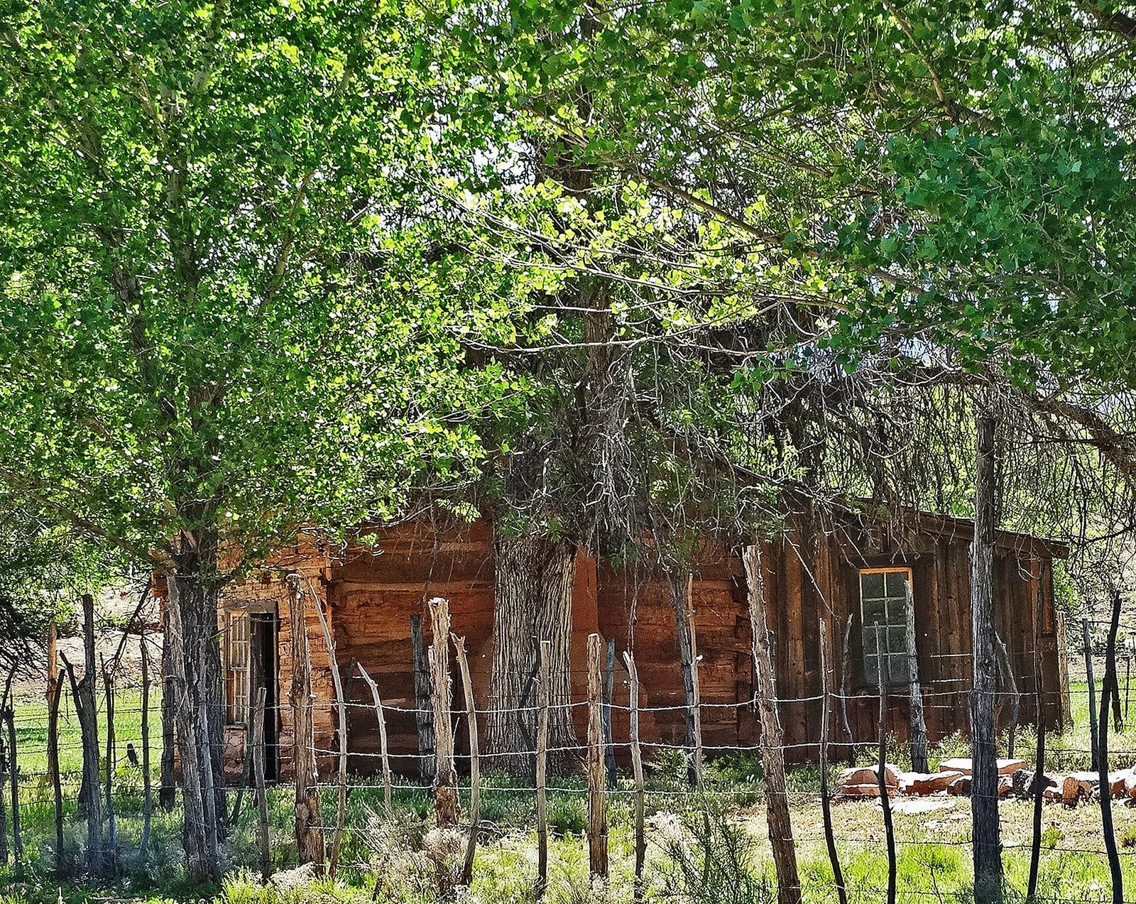
An abandoned home in Grafton, Utah. Photo: Don Graham from Redlands, CA, USA – God bless it! / Wikimedia Commons, CC BY-SA 2.0
Grafton was first settled in December 1859 as part of a southern Utah cotton-growing project ordered by Brigham Young. A group from Virgin established a settlement they called Wheeler, but it did not last. On the night of January 8, 1862, a weeks-long flood of the Virgin River, part of the Great Flood of 1862, largely destroyed it.
They rebuilt about a mile upriver and named the new town New Grafton, after Grafton, Massachusetts. The community dug irrigation canals and planted orchards, some of which still exist. The last residents left in 1944.
Said to be the most photographed ghost town in the West, Grafton has appeared in several films, including 1929’s In Old Arizona, the first talkie filmed outdoors, and Butch Cassidy and the Sundance Kid. It sits just south of Zion National Park at 3,673 feet, now inside the legal boundaries of nearby Rockville.
- Founded: 1859
- Elevation: 3,673 ft
- Nearest living town: Rockville, UT, 1.9 miles in a straight line
Explore Grafton on Wayfarrow: map, old USGS topo and today’s aerial view (Source)
13. Rhyolite, Nevada
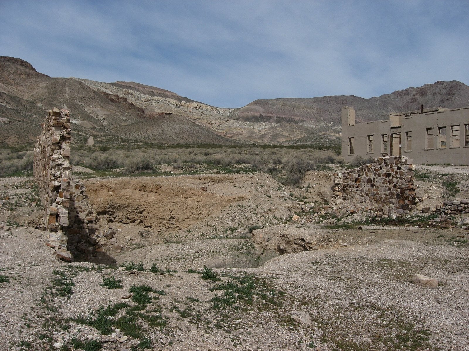
Ruins in Rhyolite, Nevada. Photo: Ken Lund from Las Vegas, Nevada, USA / Wikimedia Commons, CC BY-SA 2.0
Rhyolite began in early 1905 as one of several mining camps that sprang up after a prospecting strike in the Bullfrog Hills. A gold rush followed, and thousands of gold-seekers, developers, miners and service providers flocked to the Bullfrog Mining District. Many settled in Rhyolite, in a sheltered desert basin near the region’s biggest producer, the Montgomery-Shoshone Mine.
The decline was just as swift. As mines reduced output or closed, miners drifted off to find work, businesses failed, and by 1910 the census reported only 675 residents. The post office closed in November 1913, the last train left Rhyolite Station in July 1914, and the power company turned off the electricity and pulled its lines in 1916.
The historic townsite, maintained by the Bureau of Land Management, is called one of the most photographed ghost towns in the West. Ruins include the railroad depot and the Bottle House, restored in 1925 for a silent movie. The Cook Bank building has appeared in films from 1964 through 2004, and the town stood in for a collapsed society in a 1988 science-fiction picture. Rhyolite sits at 3,816 feet, near Death Valley’s edge.
- Elevation: 3,816 ft
- Nearest living town: Beatty, NV, 8.6 miles in a straight line
Explore Rhyolite on Wayfarrow: map, old USGS topo and today’s aerial view (Source)
12. Independence, Colorado
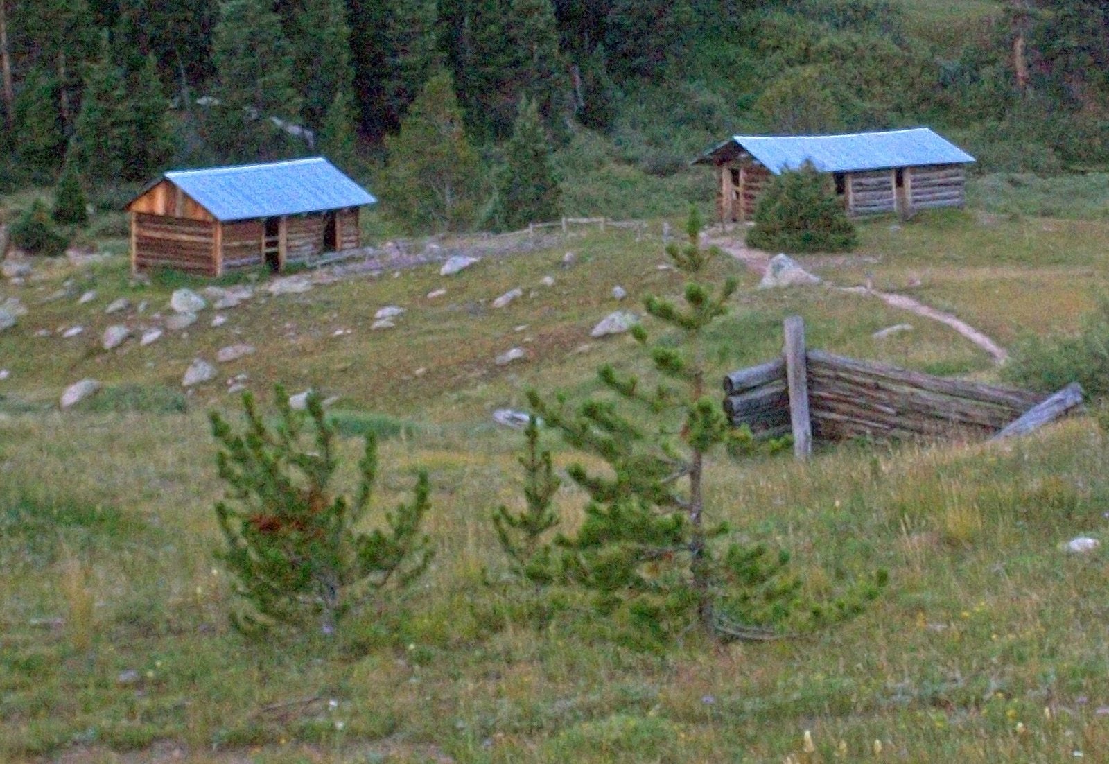
Abandoned log cabins at Independence, Colorado. Photo: Daniel Case / Wikimedia Commons, CC BY-SA 3.0
Independence was the first settlement in the Roaring Fork Valley. On July 4, 1879, miners at a small camp just below the Divide struck gold, named it the Independence claim for the holiday, and a tent city grew on the spot. The town has also gone by Mammoth City, Mount Hope and Hunter’s Pass.
It lost ground over the following decade as Aspen rose nearby and became the county seat. It has been a ghost town since at least 1912. The buildings were left to deteriorate, though some mining claims stayed active for a time. In its heavy winters, the site was vulnerable to avalanches, especially down a south slope that had been deforested for the mines.
In 1973 it was listed on the National Register of Historic Places. Of the structures, a total of 26 remain in some form, and of those, eight are intact and standing; the rest are just foundations. Further west, below Highway 82, is the large site of the former Farwell Mill, with some supporting timbers still visible. Independence sits high, at 10,929 feet, about 14 miles from Aspen.
- Elevation: 10,929 ft
- Nearest living town: Aspen, CO, 13.8 miles in a straight line
Explore Independence on Wayfarrow: map, old USGS topo and today’s aerial view (Source)
11. Lake Valley, New Mexico
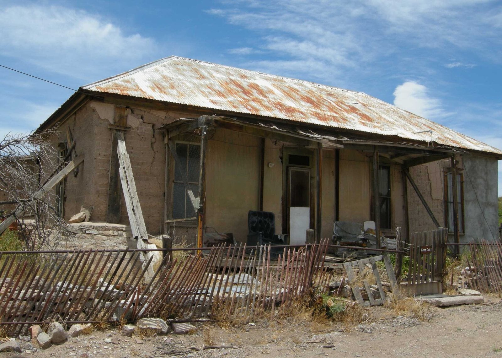
The Bella Hotel in Lake Valley, New Mexico. Photo: Plazak (talk) / Wikimedia Commons, CC BY-SA 3.0
A rancher found the silver deposits of Lake Valley in Sierra County in 1876. Two years later he sold his claims to an engineer, who began mining in earnest. The town’s heyday ran from 1881 to 1893.
The mines produced well for a few years, and one strike became legend: miners tunneled into a silver-lined cavity they named the “bridal chamber,” which alone yielded 2.5 million troy ounces of silver.
The last resident departed in 1994, and the present-day ghost town is deserted. It sits at 5,381 feet, about 14 miles from Hillsboro.
- Elevation: 5,381 ft
- Nearest living town: Hillsboro, NM, 14.1 miles in a straight line
Explore Lake Valley on Wayfarrow: map, old USGS topo and today’s aerial view (Source)
10. Thurmond, West Virginia
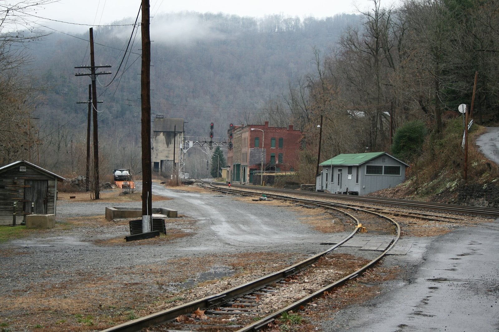
The rail yard and old storefronts of Thurmond, West Virginia. Photo: Ncjks / Wikimedia Commons, CC BY-SA 4.0
Thurmond stands on the New River, named for Captain W. D. Thurmond, who settled here in 1844 and received the 73-acre site in 1873 as payment for a surveying job. The town was incorporated in 1903. During the heyday of coal mining in the New River Gorge, it was a prosperous place, with businesses and facilities serving the Chesapeake and Ohio Railway.
The 2020 census recorded a population of 5. Most of the town is now owned by the National Park Service, part of the New River Gorge National Park and Preserve, and the entire town is a designated historic district on the National Register of Historic Places.
The old C&O passenger depot was renovated in 1995 and now serves as a Park Service visitor center. Thurmond sits at 1,106 feet, about three miles from Gatewood.
- Elevation: 1,106 ft
- Nearest living town: Gatewood, WV, 3.1 miles in a straight line
Explore Thurmond on Wayfarrow: map, old USGS topo and today’s aerial view (Source)
9. Cerro Gordo, California
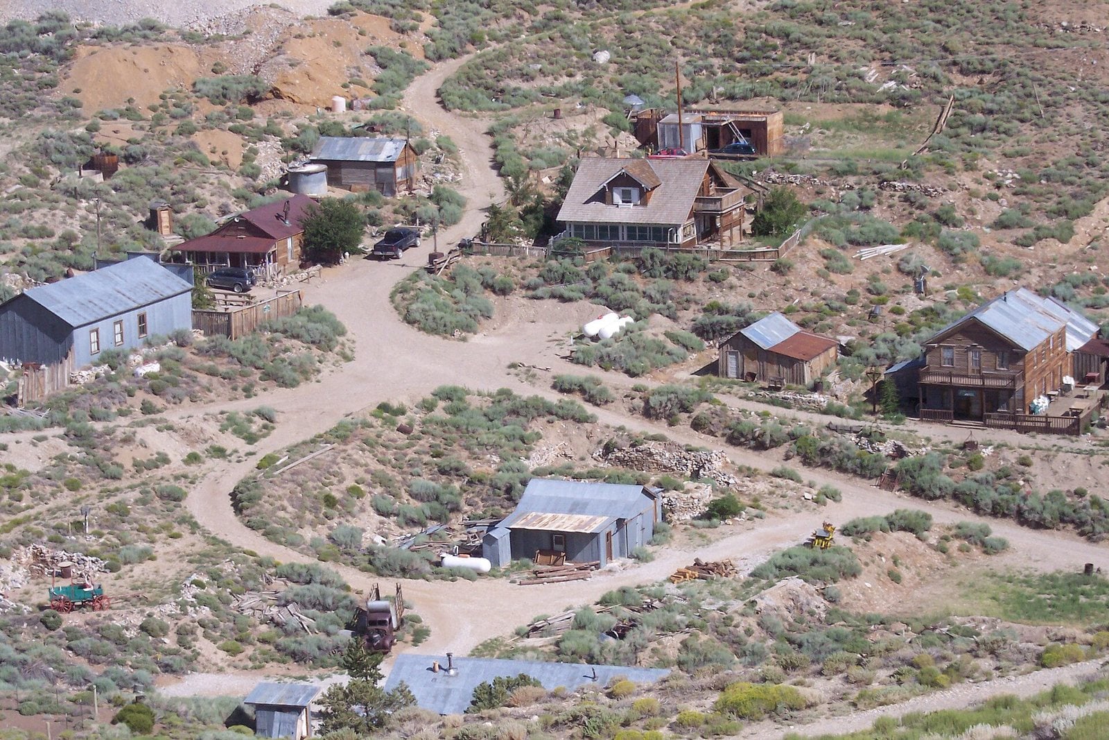
The buildings of Cerro Gordo from the hillside above, California. Photo: David Lofink from Orange, United States / Wikimedia Commons, CC BY 2.0
The Cerro Gordo Mines sit high in the Inyo Mountains, where silver ore was discovered by Pablo Flores, who began mining and smelting near the summit of Buena Vista Peak in 1865. Early efforts met resistance from the Owens Valley Paiute people, whose presence limited the mining until the re-occupation of Fort Independence allowed the town to expand.
Operations ran from 1866 to 1957, producing high-grade silver, lead and zinc, and more rarely gold and copper. Some ore was smelted on site, but larger smelters rose along the shore of nearby Owens Lake, and most of the metal ingots were hauled to Los Angeles. Silver and lead peaked in the early 1880s; a second boom in zinc came in the 1910s, and by 1912 Cerro Gordo was the largest producer of zinc carbonates in the country. The town was electrified in 1916.
By 1920, about ten miners still worked, mostly for silver-lead ore. The American Hotel, built in 1871, was the oldest standing hotel on the east side of the Sierra until a fire destroyed it and neighboring buildings. The site sits at 8,126 feet, about six miles from Keeler.
- Elevation: 8,126 ft
- Nearest living town: Keeler, CA, 5.6 miles in a straight line
Explore Cerro Gordo on Wayfarrow: map, old USGS topo and today’s aerial view (Source)
8. Kaymoor, West Virginia
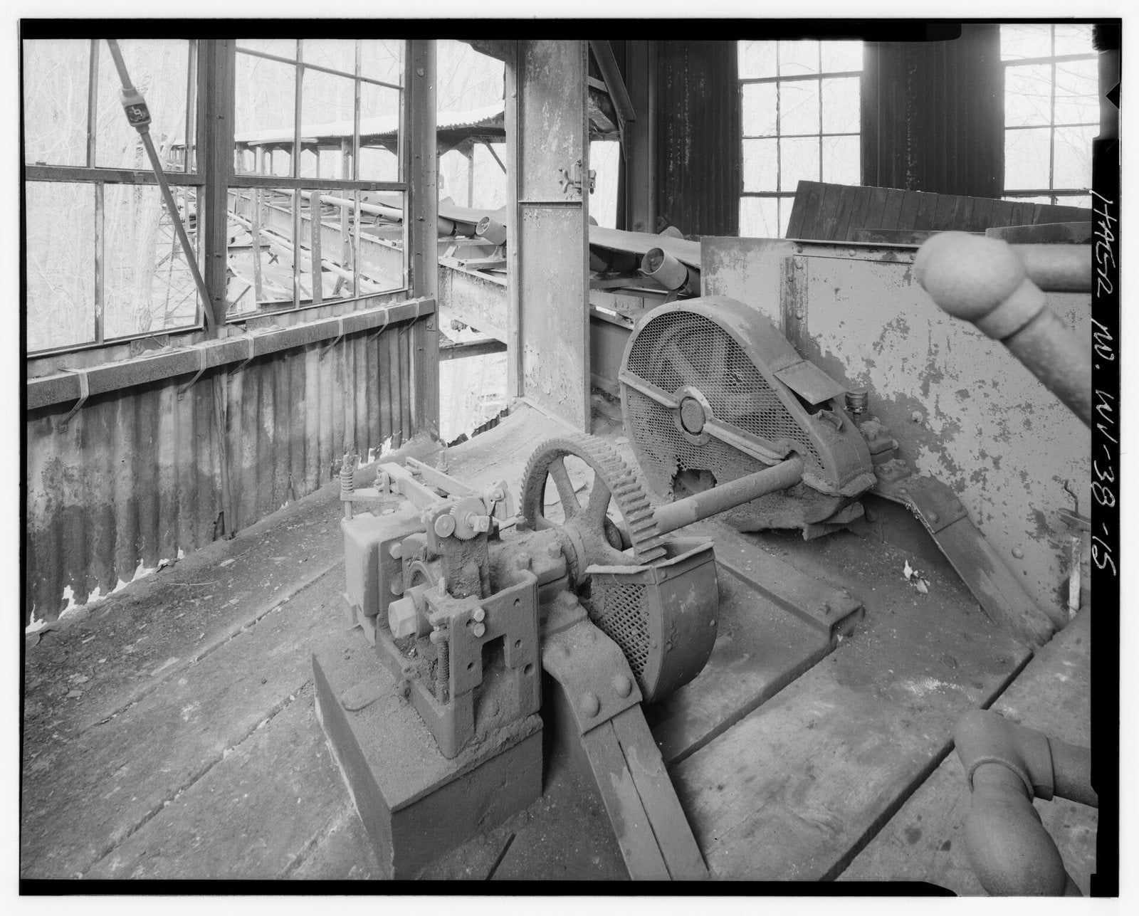
Drive motors and gearing left in the Kaymoor screening building (Historic American Engineering Record), West Virginia. Photo: Unknown photographer / Wikimedia Commons (public domain)
Kaymoor was a coal mine, processing plant and company town stacked down the wall of the New River Gorge. The town site sat at Kaymoor Bottom, linked by conveyors to the mine portal 560 feet above on Sewell Bench, with a third piece, Kaymoor Top, at the gorge rim. The mine worked the Sewell Seam of “smokeless” low-volatile bituminous coal, reachable only by the C&O’s mainline in the gorge.
The property was bought in 1873 by Abiel Abbot Low of the Low Moor Iron Company, held in reserve, then opened in 1899 to feed the company’s blast furnaces. The town was named for James Kay, the Low Moor employee who oversaw building it. In 1925 the mine was sold to a subsidiary of the Berwind-White Corporation of Philadelphia.
Workers and equipment rode a single-track incline up a 1,000-foot slope at a 30-degree angle. The site is now heavily overgrown, and structures and machinery have deteriorated where coal dust and rainwater have worked at them. Even so, Kaymoor still holds significant amounts of mining machinery and is considered one of the most complete examples of an integrated coal mine and company town in West Virginia. It sits at 911 feet.
- Elevation: 911 ft
- Nearest living town: Garten, WV, 1.5 miles in a straight line
Explore Kaymoor on Wayfarrow: map, old USGS topo and today’s aerial view (Source)
7. Glenrio, Texas
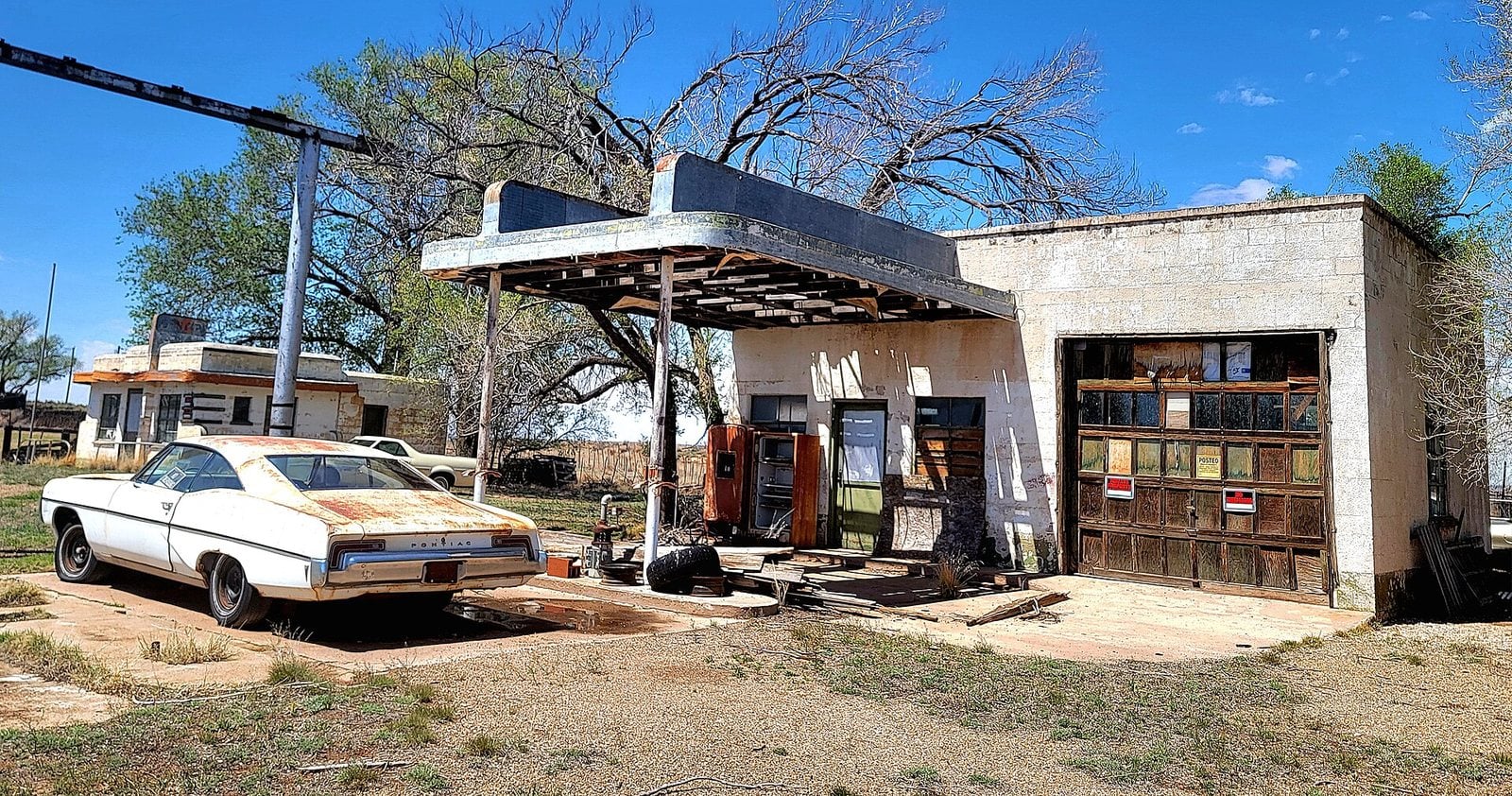
An abandoned gas station and car in Glenrio, Texas. Photo: Cullen328 / Wikimedia Commons, CC BY-SA 4.0
Glenrio sits astride the Texas–New Mexico state line, which runs right through town. Founded in 1903 as a railroad siding on the Rock Island Railroad, it was originally called Rock Island, renamed Glenrio in 1908, and began receiving motorists on the dusty Ozark Trail in 1917. Its original structures were adobe buildings, including the circa-1910 Angel House on the New Mexico side.
The Ozark Trail was formed into U.S. Route 66 in November 1926, which carried the town’s traffic for decades along the old highway.
Then Interstate 40 bypassed the community, and the motorists, and the business they brought, were gone. A few homes still stand; the Joseph Brownlee House and an office in the Texas Longhorn Motel were the last buildings to be occupied. Glenrio’s historic district was listed on the National Register of Historic Places in 2007, and only one business, a cannabis dispensary on the New Mexico side, operates today. Glenrio sits at 3,858 feet, about 17 miles from San Jon.
- Elevation: 3,858 ft
- Nearest living town: San Jon, NM, 17.3 miles in a straight line
Explore Glenrio on Wayfarrow: map, old USGS topo and today’s aerial view (Source)
6. Mogollon, New Mexico
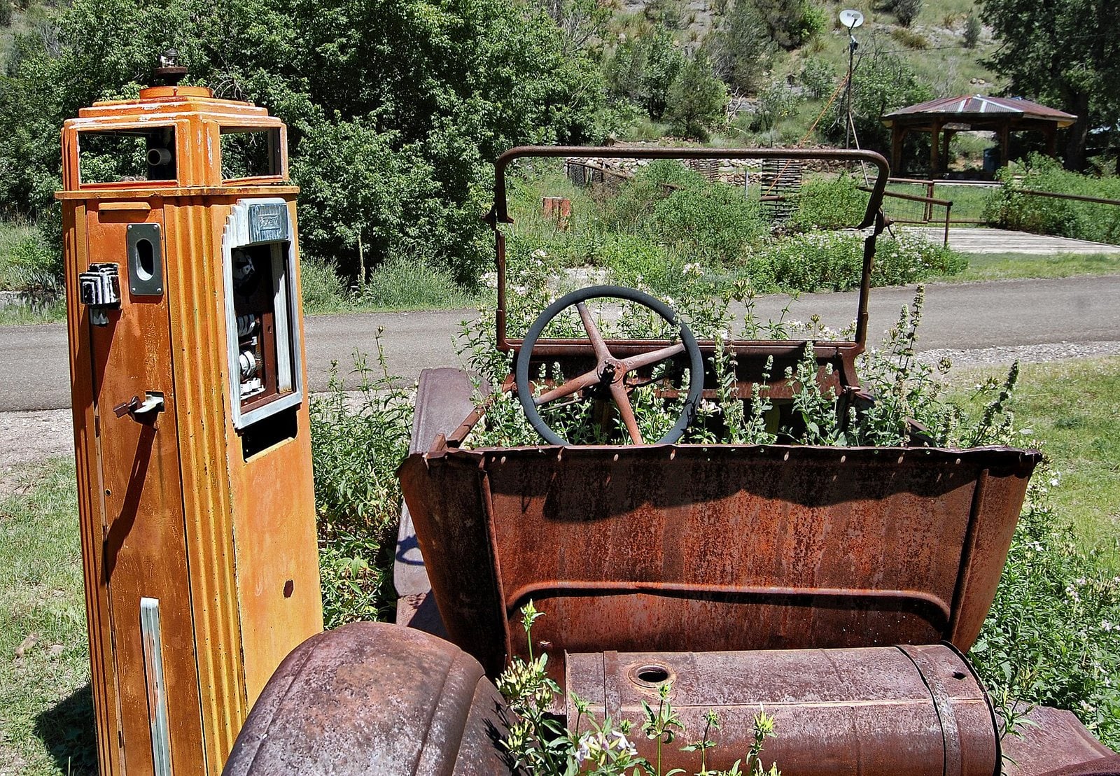
An old car and gas pump left in Mogollon, New Mexico. Photo: Tom Blackwell from UK / Wikimedia Commons, CC BY-SA 2.0
Mogollon was founded in the 1880s at the bottom of Silver Creek Canyon, in the mountains that share its name, to support the gold and silver mines in the surrounding peaks. A miner named John Eberle built the first cabin in 1889. A jail and post office opened in 1890, and the first school followed in 1892. The “Little Fannie” mine became the town’s most important employer.
During the 1890s, Mogollon held a transient population of between 3,000 and 6,000 miners. Isolated and rough, it earned a reputation as one of the wildest mining towns in the West.
Today it is listed as the Fannie Hill Mill and Company Town Historic District on the National Register of Historic Places. It sits at 6,628 feet, east of Glenwood and Alma, with the nearest living town, Alma, about six miles off.
- Elevation: 6,628 ft
- Nearest living town: Alma, NM, 5.8 miles in a straight line
Explore Mogollon on Wayfarrow: map, old USGS topo and today’s aerial view (Source)
5. Elkhorn, Montana
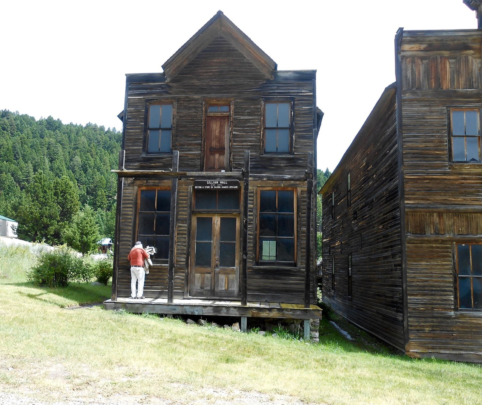
Weathered two-story halls in Elkhorn, Montana. Photo: Montanabw / Wikimedia Commons, CC BY-SA 4.0
Elkhorn was established as a mining town in the 19th century, founded in 1872 in the Elkhorn Mountains. Silver lodes, which geologists describe as supergene enrichments, were first found by Peter Wys, a Swiss immigrant. Six years later, Anton Holter, a capitalist from Helena, began developing the mine. Over $14 million in silver was carried out, and the 1890 Sherman Silver Purchase Act drove demand higher still.
In 1893 the Fraternity Hall was built for social gatherings, and it remains one of the best-preserved buildings in Elkhorn today. The 2020 census counted a population of 12.
Only minimal standing buildings survive of the original town, and two of them are preserved as Elkhorn State Park. Some of the old cabins have been reoccupied and refurbished. The community sits at 6,445 feet, about eight miles from Jefferson City.
- Founded: 1872
- Elevation: 6,445 ft
- Nearest living town: Jefferson City, MT, 8.2 miles in a straight line
Explore Elkhorn on Wayfarrow: map, old USGS topo and today’s aerial view (Source)
4. Animas Forks, Colorado
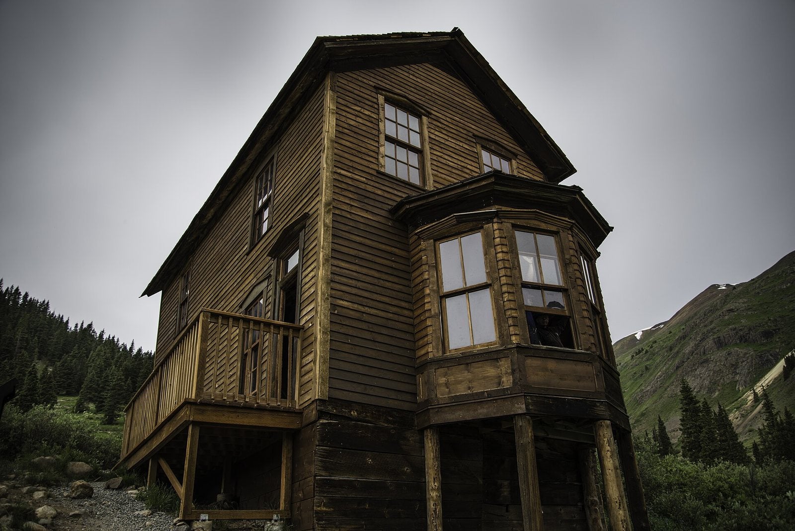
A two-story house standing alone in Animas Forks, Colorado. Photo: Int77345 / Wikimedia Commons, CC BY-SA 4.0
Animas Forks sits high in the San Juan Mountains, about 12 miles northeast of Silverton. The town’s first log cabin went up in 1873, and the post office opened in February 1875. By Colorado’s statehood in 1876 it was a bustling mining community with 30 cabins, a hotel, a general store and a saloon. By 1883, 450 people lived here, and a newspaper, the Animas Forks Pioneer, ran from 1882 until October 1886.
Winter was severe enough that every fall the residents migrated en masse down to warmer Silverton. When mining profits fell, further investment no longer made sense. A brief rebound came in 1904 with the Gold Prince Mill, but the town’s mining days were nearly over.
Today the area is managed by the Bureau of Land Management. The nine standing buildings within the townsite have been stabilized and restored, their floors, walls, windows and doors repaired to secure each structure. Animas Forks sits at 11,203 feet, about nine miles from Ouray.
- Elevation: 11,203 ft
- Nearest living town: Ouray, CO, 8.7 miles in a straight line
Explore Animas Forks on Wayfarrow: map, old USGS topo and today’s aerial view (Source)
3. Saint Elmo, Colorado
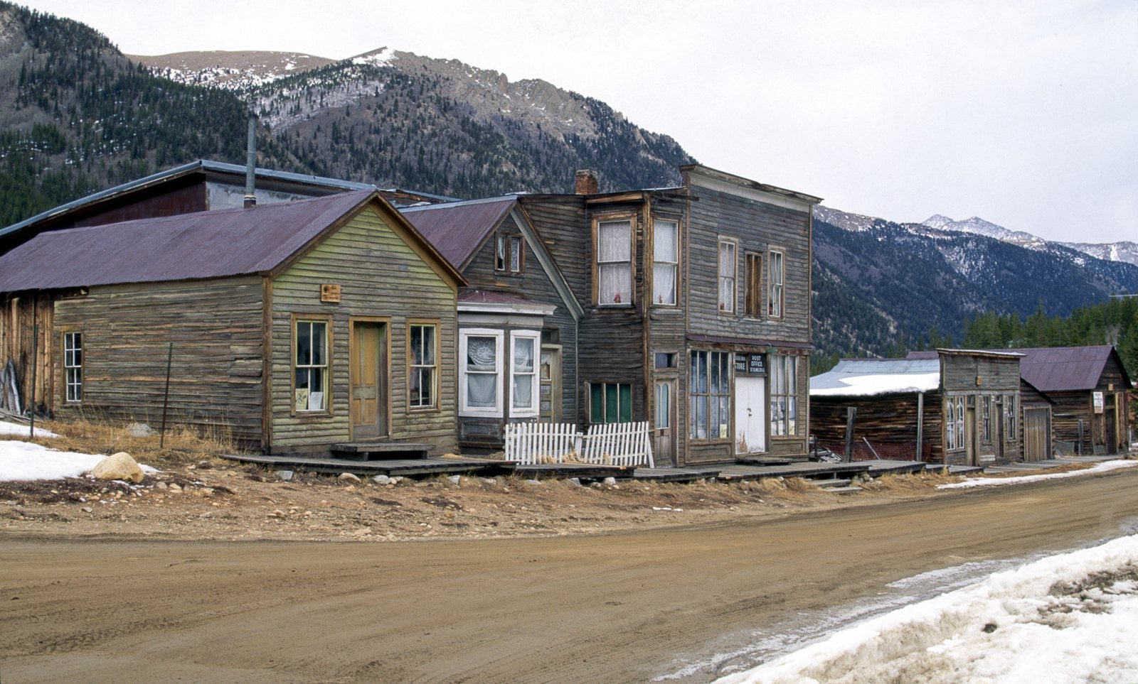
Old storefronts along the main street of Saint Elmo, Colorado. Photo: Dariusz Kowalczyk / Wikimedia Commons, CC BY-SA 3.0
Nearly 2,000 people settled in Saint Elmo when gold and silver mining began. Originally named Forest City, it was renamed because so many towns shared that name; the name Saint Elmo came from a founder who was reading a novel of the same title. At its peak in the 1890s, the town had a telegraph office, general store, town hall, five hotels, saloons, dancing halls, a newspaper office and a school house. Its longest-running paper, the St. Elmo Mountaineer, reported on mining from August 1880 until 1895.
Mining began to decline in the early 1920s, and in 1922 the railroad discontinued service, which sealed the town’s fate.
It is listed on the National Register of Historic Places as the Saint Elmo Historic District and counts among Colorado’s best-preserved ghost towns. It is still inhabited, and many tourists visit, with the former mining roads now used as off-road vehicle trails. Saint Elmo sits at 10,013 feet, about 11 miles from Pitkin.
- Elevation: 10,013 ft
- Nearest living town: Pitkin, CO, 11.2 miles in a straight line
Explore Saint Elmo on Wayfarrow: map, old USGS topo and today’s aerial view (Source)
2. Bannack, Montana
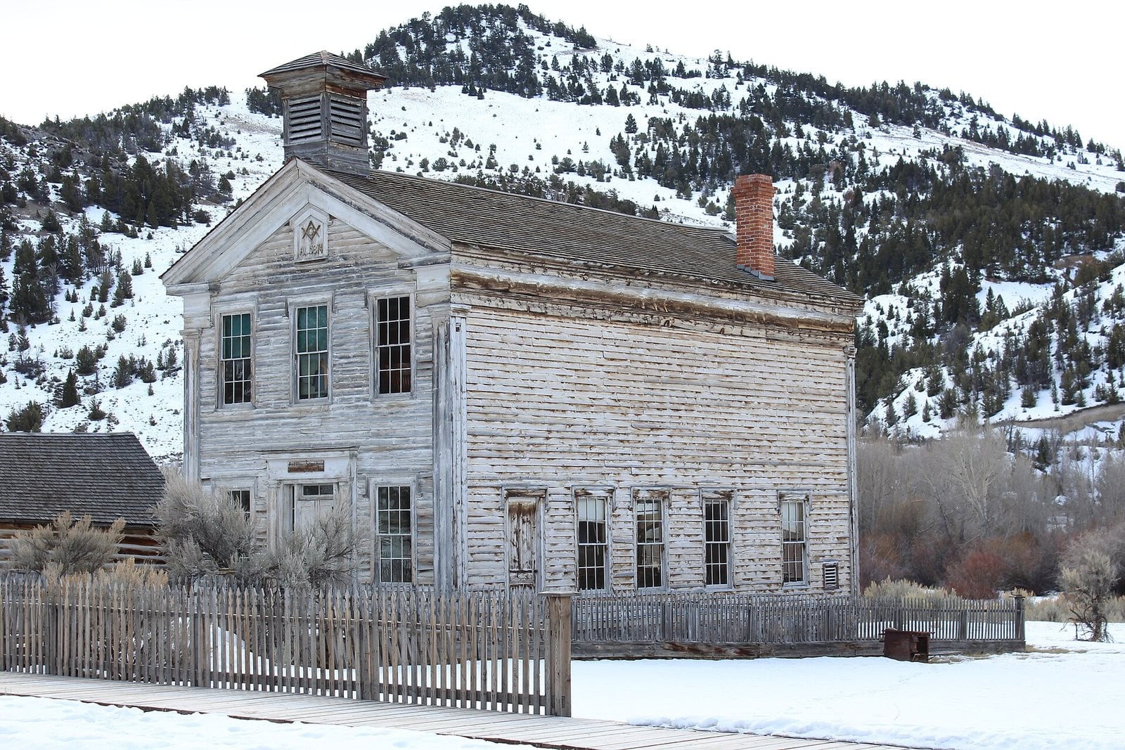
The schoolhouse and Masonic Lodge building in Bannack, Montana. Photo: Mark Holloway from Anaconda, Montana / Wikimedia Commons, CC BY 2.0
Bannack was founded in 1862 on Grasshopper Creek, named after the local Bannock natives, and it was the site of a major gold discovery that same year. It briefly served as the capital of Montana Territory in 1864, until the capital moved to Virginia City. At its peak, Bannack and the smaller settlements in the same gulch totaled around 5,000 people. The town carried on as a mining community even as the population dwindled, and the last residents left in the 1970s.
Today Bannack is a National Historic Landmark, managed by the state of Montana as Bannack State Park.
Sixty historic log, brick and frame structures remain standing, many very well preserved, and most can be explored. An old-fashioned breakfast is served in the old Hotel Meade, a well-preserved brick building that was once the seat of Beaverhead County. Bannack sits at 5,775 feet, about ten miles from Argenta.
- Founded: 1862
- Elevation: 5,775 ft
- Nearest living town: Argenta, MT, 10.5 miles in a straight line
Explore Bannack on Wayfarrow: map, old USGS topo and today’s aerial view (Source)
1. Bodie, California
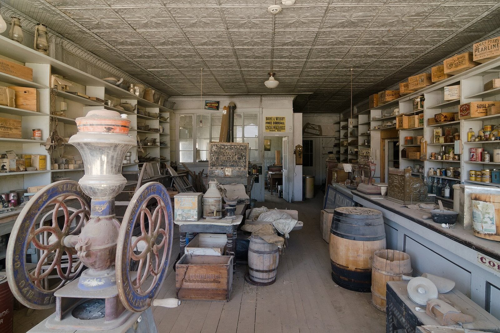
A Bodie store interior, its shelves still lined with goods, California. Photo: King of Hearts / Wikimedia Commons, CC BY-SA 4.0
Bodie became a boom town in 1876 after a rich vein of gold turned up. By 1879 it had 2,000 structures and a population of roughly 8,000 people. The first signs of decline appeared in 1880, as promising booms in Butte, Tombstone and Utah lured men away. The single miners who had rushed in during the 1870s moved on, and Bodie settled into a family town. By 1882 residents had built the Methodist Church, which still stands, and a Roman Catholic church that burned in 1928. The last issue of The Bodie Miner appeared in 1912, and the place was described as a ghost town by 1915.
Bodie is a National Historic Landmark and a California Historical Landmark, officially established as Bodie State Historic Park in 1962. It receives about 200,000 visitors yearly.
Today the town is preserved in a state of arrested decay. Only a small part survived, with about 110 structures still standing, including one of the many once-operational gold mills. On Main Street stands the Miners Union Hall, once the meeting place for labor unions. Inside, interiors remain as they were left and stocked with goods, and visitors can walk the deserted streets of a town that was once a bustling center of activity. Bodie sits at 8,366 feet, about 11 miles from Bridgeport, and this is where our list ends, with the most complete of them all.
- Founded: 1876
- Elevation: 8,366 ft
- Nearest living town: Bridgeport, CA, 11.2 miles in a straight line
Explore Bodie on Wayfarrow: map, old USGS topo and today’s aerial view (Source)
The Bottom Line
What pulls us toward these places is partly the strangeness of a town stopped mid-sentence: a church that still stands, a hotel with the railway running through its lobby, a bottle house, foundations marching off into the sagebrush. They let us stand inside history rather than read about it, and feel how quickly a thriving place can empty out when the ore runs thin or the highway moves on.
If you go, go gently and go informed. Much of the land around old townsites is private, fenced and posted, and some of these places survive only because they are carefully managed. Check access before you set out, respect the markers and closures, and leave each ruin standing for whoever comes next.
How we did this
- Ghost towns: Wayfarrow.com maps 10,908 U.S. ghost-town pages built from the USGS Geographic Names Information System (historical populated places), Wikidata and the National Park Service.
- We kept towns with standing buildings, machinery or vehicles still on site and a well-documented history, then picked the 27 where the most was left behind.
- Founding years, elevations and nearest living towns come from each town’s Wayfarrow record; history comes from the National Register of Historic Places, state park and Bureau of Land Management sources as summarized on Wikipedia.
- Photos: Wikimedia Commons and the Library of Congress, credited under each image with its licence.
Please note that some of the imagery in this article were created with the aid of AI image generators.