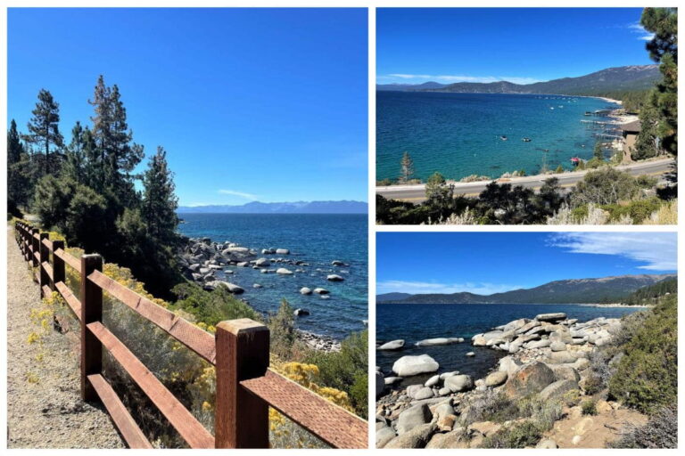
Monkey Rock is a lookout point along the Tunnel Creek Trail overlooking Lake Tahoe in northern Nevada. The trail offers scenic views of the lake and mountains, and this moderate hike can be completed in under an hour. It’s an incredible way to see Lake Tahoe, and I highly recommend it if you’re in the area.

Where is Monkey Rock?
Monkey Rock is located along the Tunnel Creek Trail, in the town of Incline Village, which sits on the northeastern end of Lake Tahoe, Nevada. The trailhead is just off Tahoe Blvd, at the intersection of Ponderosa Ranch. The trail starts at the end of Tunnel Creek Road, which runs parallel to Tahoe Blvd. Monkey Rock is a lookout point along the trail, with an interesting-looking rock. Monkey Rock overlooks the northern end of Lake Tahoe, all the way across to California on the western side of the lake.
Getting to Monkey Rock
To get to the trailhead, walk a few feet up Ponderosa Ranch Rd from Tahoe Blvd, and turn right onto Tunnel Creek Rd. Tunnel Creek Rd turns into the Tunnel Creek Trail once you’ve passed the last house on the right.

At the very start of the trail, a nice lookout overlooks Lake Tahoe’s northern end. If you’re amazed at the view here, just wait until you see the view from the top!

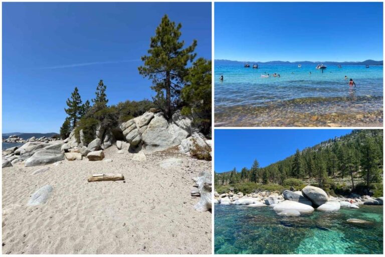
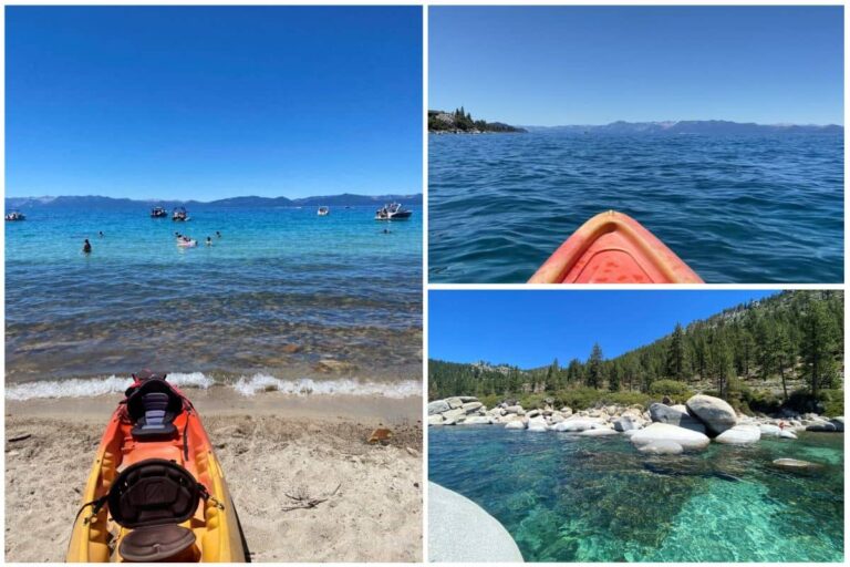
The trail is dusty and sandy, so definitely wear closed-toe footwear. Even with my sneakers on I still brought a desert full of sand home in my shoes and socks. The beginning of the trail is pretty much flat, and it runs along the shore of Lake Tahoe, and the Tahoe East Shore Trail below. You’ll have incredible views of the lake for the majority of the walk.

This section of the trail is very manageable and has just a slight incline in some areas. I walked at a pretty leisurely pace and reached the fork in the trail for the faster path to Monkey Rock in about 15 minutes.

After walking for about 15 minutes along the main path, you’ll reach a fork in the trail. The path on the left will get you to Monkey Rock in about 10 minutes, but it is very steep. If you stay to the right, you’ll loop around on a much flatter pathway, but it will take you about 5 minutes longer. If you’re looking for a workout, take the steep path, but if you want to take it easy, stick to the right.
Wildlife Along The Trail to Monkey Rock
The northern region of Lake Tahoe is a boreal, or taiga forest, so it’s comprised of pine, spruce, and fir trees. The majority of the trees in this forest are Jeffrey Pines and Sugar Pines. Jeffrey Pines are particularly special, as they give off an intensely sweet smell like freshly baked cookies or donuts. It may sound very silly, but if you get a chance, give the bark of a Jeffrey Pine tree a sniff.

Other wildlife in the area consists of your usual suspects, squirrels, chipmunks, grasshoppers, and small birds. Steller’s Jays are very prevalent in the area, you can identify them by their blue body and black crest. You might also see some small lizards, like the Western fence lizard which are common in the area.
Easy Start, Challenging Finish
As I mentioned, the fork in the path is where things can get challenging. If you stay to the left, you’re in for a very steep climb of about 10 minutes to reach the top. The path on the right side is not as steep of a climb but still has some elevation gain. From the trailhead, the trail to Monkey Rock has an elevation gain of about 500 ft[1]. The majority of this climb occurs in the last few minutes of the hike. However, the hike is quite short. It took me about just 30 minutes to reach Monkey Rock from the trailhead at Tahoe Blvd. Overall the hike to Monkey Rock is moderately challenging, but the difficulty can differ depending on your fitness level.

How long does it take?
On average it takes about “1 hour and 16 minutes to complete”[1], (there and back) though I finished in about an hour. The length of time it will take you to complete this trail will depend on your fitness level, how many breaks you take, etc.

Can someone please remind me why I took the steepest route? That’s right, to get to the amazing views at the top even faster! Make sure to bring plenty of water as this trail gets lots of sun, and can be steep and challenging in some sections!
Views From the Top
Once you finished the climb you’ll see a large stack of boulders at the top. This is where the lookout is, just a few more steps and you’re there!

As you can see, the views from the top are absolutely awesome. You can see all the way across Lake Tahoe to the California side, and the winding Tahoe Blvd on the left. Don’t just enjoy the pictures, see the view for yourself! It’s even more beautiful in person.

To the right, you can see a long stretch of beaches, and the amazing houses that sit along the shore. Further down the sand is Ski Beach, and Incline Beach in Incline Village, Nevada. The view from Monkey Rock is breathtaking, so sit and stay for a while to catch your breath before taking the trip back down the hill. There are large boulders all along the area that you can sit on and enjoy the view, and also get some great photos yourself.

Why is it called Monkey Rock?
So, why is it called Monkey Rock? I had this same question when I first did this hike last spring. If you haven’t already seen the monkey of Monkey Rock, then you’re in for a cheeky surprise. This trail and lookout are named after the large rock formation that shares a striking resemblance with a gorilla, which you can see in the image below.

I’ve not been able to find much information on how this monkey first came to be. There are elements of the rock that look naturally formed, however, some shapes seem to have been carved into the rock to make the apelike qualities even more uncanny. Regardless, it’s a hilarious addition to the striking views of the Spooner Backcountry State Park.

This hike gives you a pretty major bang for your buck, with insane panoramic views of Lake Tahoe, in just a short distance. If you are visiting the northern Lake Tahoe area, you should not skip this quick and picturesque hike!
Other Features in the Area
Back at the trailhead, there are a few more things you can check out. The Tunnel Creek Cafe is rather conveniently located at the trailhead. Stop here for some fuel before you head out on your hike, or enjoy a celebratory coffee or treat when you’re done!
The Tahoe East Shore trailhead is also located here, a scenic trail that runs along the Lake Tahoe shore and Tahoe Blvd. The trail takes you to Hidden Beach on Lake Tahoe, which is about a 20-minute walk from the trailhead.
Lastly, just behind the Tunnel Creek Cafe is Flume Trail Bikes. Flume Trail Bikes offers mountain bike rentals which you can take along the East Shore trail, or on the trail up to Monkey Rock!

FAQs About Monkey Rock
Is Monkey Rock busy?
The trail to Monkey Rock and the lookout can be very busy, depending on when you go. The hike is most popular in the summer and early fall, especially on weekends. I’ve done the hike twice, both on weekdays, and the trail wasn’t very busy. I crossed paths with under a dozen people. On sunny weekends, however, the trail can be very busy, with lots of people stopping at the top to take pictures.
Is there parking at Monkey Rock?
There is a large pay-parking lot at the trailhead on Tahoe Blvd and Ponderosa Ranch Rd.
Are there public restrooms at Monkey Rock?
There are outhouses at the end of the southern parking lot along Tahoe Blvd, right in front of Flume Trail Bikes.
Article Sources:
- All Trails. “Monkey Rock“


